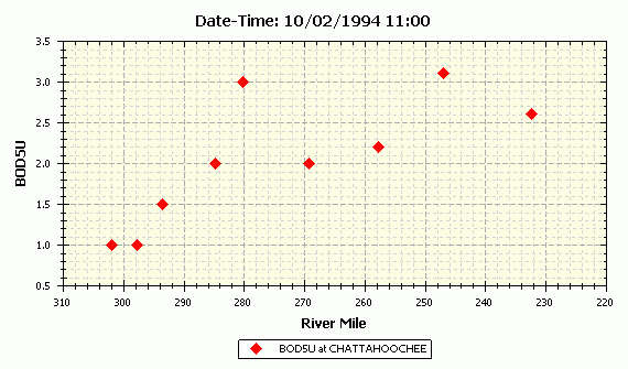
Longitudinal profiles display data from all selected stations versus location at a selected time. WRDB data tables store the Station ID but the location (e.g., river mile) for each station ID is stored in the Stations Support table. Therefore, only data points having Station IDs that already exist in the Stations table and which also have a valid rive mile will be plotted:

Observed data are rarely collected or obtained at many locations at the exact same time, therefore the concept of time window. By selecting the desired date-time and time window, you are specifying the range of date-times queried for display. For example, suppose the date-time is 5/2/97 0:00 and time window is 1 day. That means that all data between 5/1/97 12:00 and 5/2/97 12:00 will be plotted.
When the time window is large enough, it is possible that multiple values will appear at the same rivermile. You can plot these multiple values if you wish, or you can select the Box & Whisker symbol type which will make the graph look like this:

The Box and Whisker symbol is dynamically drawn to show the median value, the Q25 and Q75 values (the "box"), and the minimum and maximum values (the "whiskers"). When the line is drawn, it goes through the median value for that river mile.
You can set the date-time and time window for individual series using the Manage Series form, and they need not be the same. Do this by selecting the Branch and PCode of interest then click an Add to Axis button. After it has been added, the date-times and time windows can be selected from the list of available values. Thus you can compare longitudinal profiles from two distinct time periods.
If you set the date-time and/or time window using the main menu, toolbar, or animation toolbar, all series will be reset to the same date-time and time window. This would be desired if you want to compare observed and computed model results at the same time.
The X-Axis type is normally River Mile, however for BMD model output files, you have the option of plotting versus segment number (all non-BMD data will be surpressed in this case).
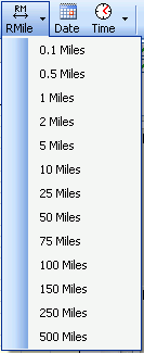
Normal procedures can be used to set the axis scale and zoom in or out (see Using the Graph Control) or you can easily set the river mile range using the Graph menu to toolbar item to one of several standard values:
