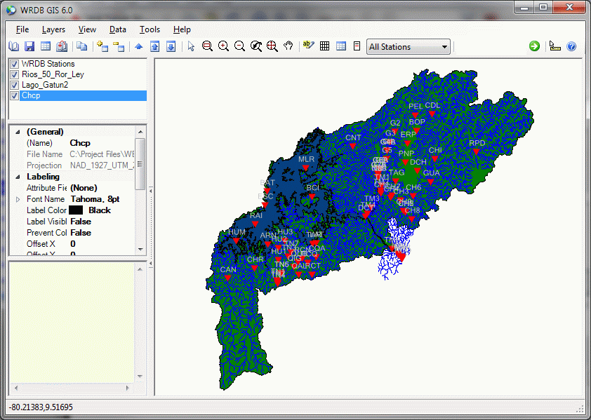
The GIS form looks like this:

The main menu and toolbar functions will be described in detail in GIS Menu and Toolbar. The panel at the left contains three items:
GIS layer list: layers that have been added to the map are shown here; layers in the list are the same as their display order (e.g., layers at the top of the list are drawn "on top" of layers below). Layer order becomes important when displaying filled polygons and can be controlled either by using the Layers menu or by right-clicking on the layer list.
Layer properties: when you select a layer in the list, its properties are displayed here. Click on the items to control display preferences.
Item information: as you move your mouse, this panel will contain detailed information about the object you are hovering over.
The GIS map is shown in the panel to the right. You can use the View menu and toolbar items to zoom and pan, or you can roll the mouse wheel to zoom in and out or click and hold the mouse wheel to pan.
The status bar at the bottom or the screen displays the latitude and longitude of your current mouse position as well as progress information during calculations.