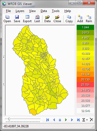
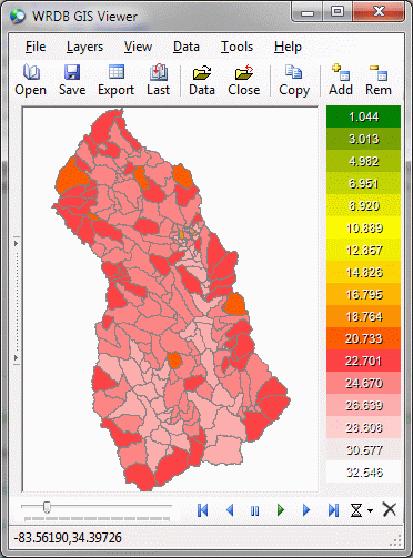
Model output can be animated by linking a polygon layer to a model's time series output file based on the Station_ID field. For example, when running the LSPC model, each subbasin is given an ID which is considered to be a Station ID. By creating a polygon shapefile which has that same Station ID as one of the fields in the attribute table, WRDB can perform animation such that the color of the fill in each polygon is related to the magnitude of the particular parameter being displayed. For example, the Oconee, Georgia, LSPC watershed model was run for several years. The average monthly air temperature was selected for animation. The thematic maps are shown below:
|
January 1999 |
July 1999 |
|
|
|
The color-coded polygons clearly show where the "hot spots" are. The animation toolbar at the bottom of the screen has the following controls:
time step trackbar: changes the desired aggregation period (hover on trackbar to see current date-time)
go to beginning of data
go to previous time step
pause animation
continue animation (clicking here will toggle play/pause too)
go to next time step
go to end of data
set animation speed
hide animation toolbar