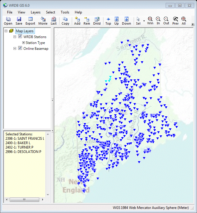
GIS features are integrated into WRDB at many levels. Here is an example
of a display of stations in your project on a web map. The WRDB GIS tool also
can be used to select stations being queried.
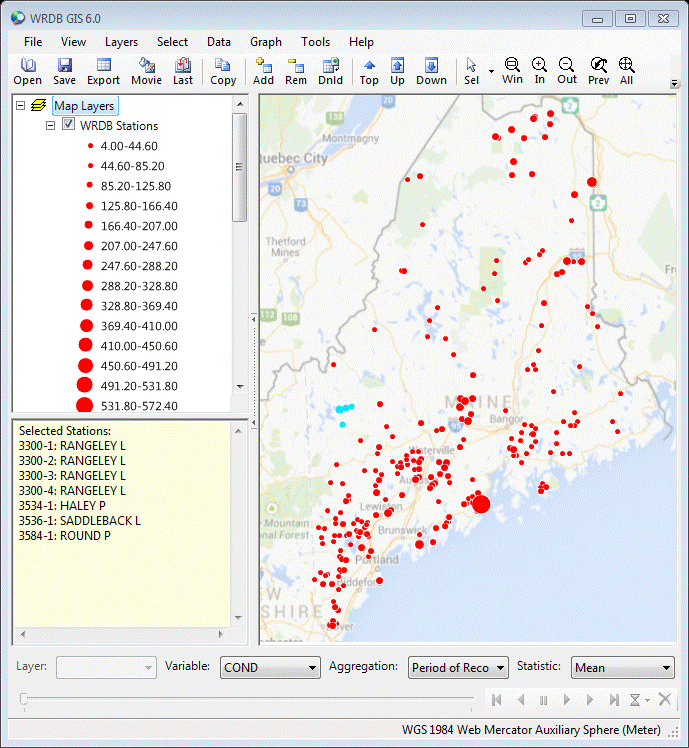
WRDB GIS can be used to visualize the spatial distribution of your data.
You can aggregate the data by day, month, year, etc., and learn how the spatial
distribution changes in time displaying symbols the size of which is associated
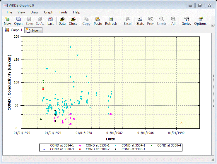
with a statistic you specify (mean, median, min, max, etc.). The WRDB Graph
program is also integrated with this tool, and you can select stations for
which graphs will be displayed. You can even animate the GIS and Graph views
simultaneously and store the images as movies.