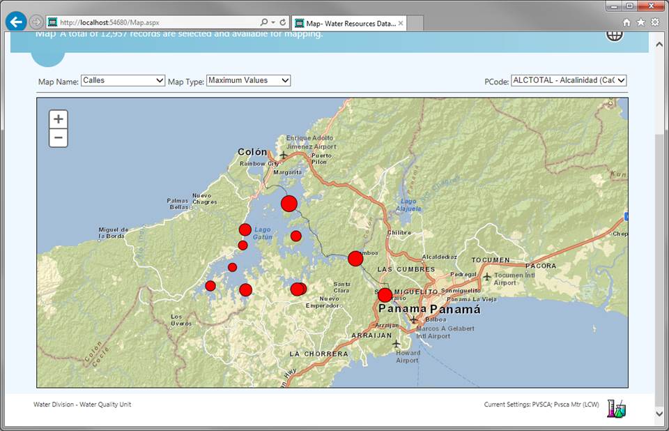
GIS features allow the display of water resources data on a map so as to
visualize spatial trends displaying symbols the size of which is associated
with a statistic you specify (mean, median, min, max, etc.) for a specified
parameter.
Standard basemaps can be selected from a list.